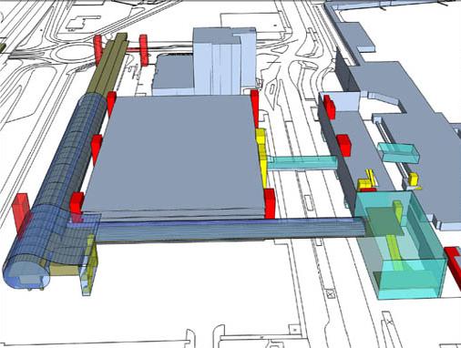
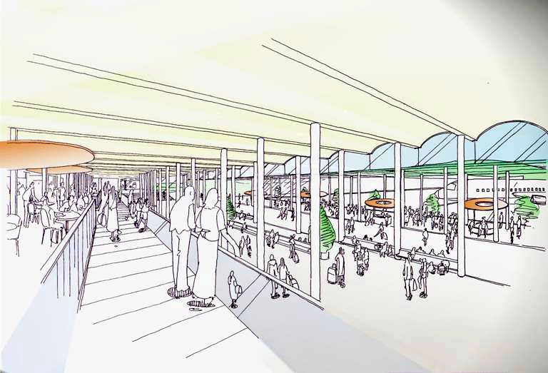
BY 2009 Terminal 2 will be replaced by a Ł30 million split level extension linking it with Terminal 1, this increased facility will cater for expanded shopping and a new combined security screening area.
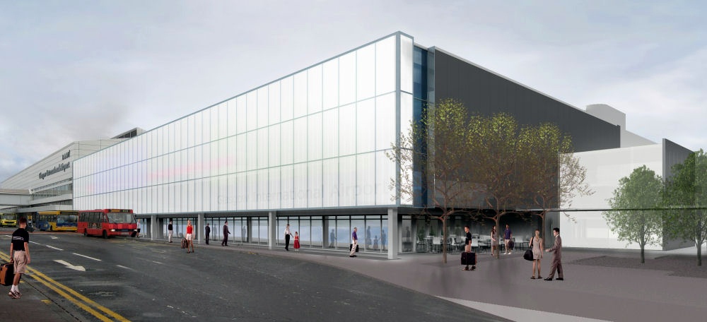
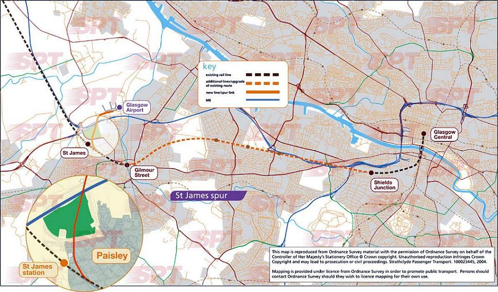
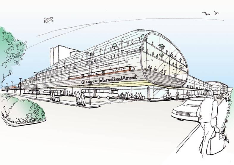
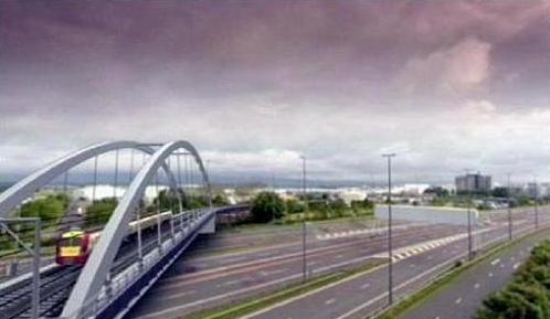
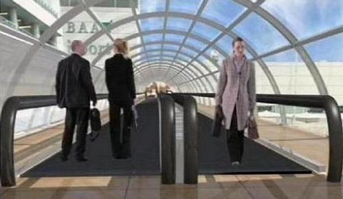
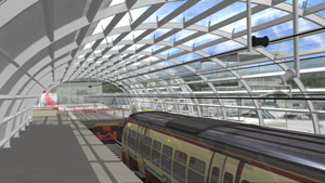
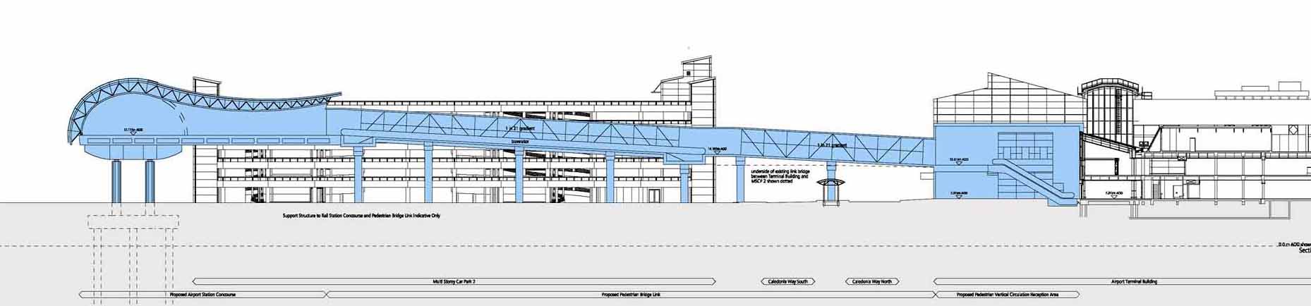
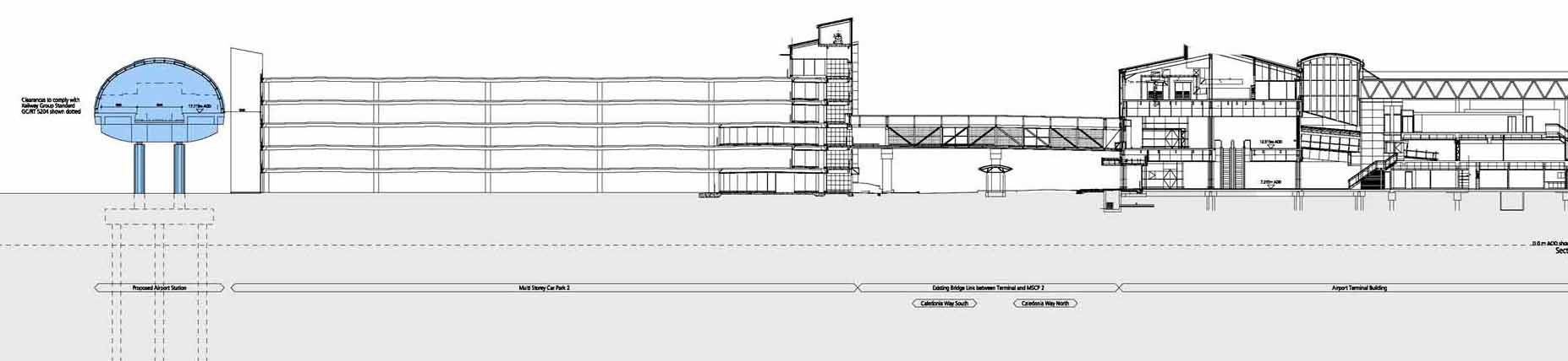
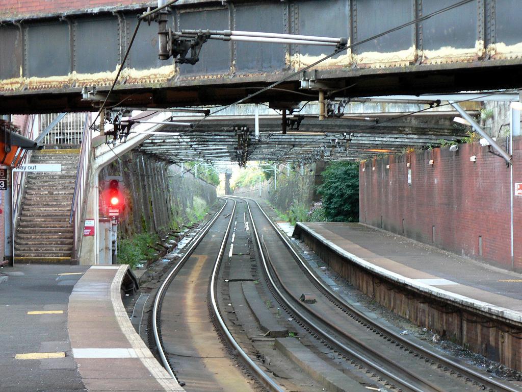
BY 2010 The Glasgow Airport Rail Link (GARL) will constitute a 2km spur line from Paisley Gilmour St to Glasgow Airport housed within a signature terminus behind today's MSCP, Travellator connections should mitigate imperfect positioning. The station will provide integrated public transport whilst safeguarding future terminal expansion and will provide clarity of arrival with its physical presence. A service will run every 15 min's from Glasgow Airport to Glasgow Central by way of spur and Viaduct across St James's Park and the M8.
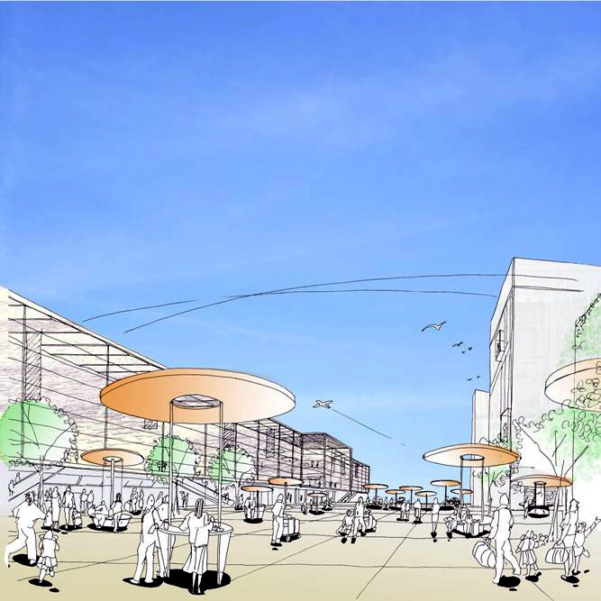
BY 2015 today's drop off point will be pedestrianised to create a "continental walkway" with pavement cafe's, achieved by reconfiguring access routes. As International and domestic arrivals are to be consolidated a new arrivals forecourt will be required by expanding the current court by 50%. Further expansion by way of a new west pier and MSCP is also planned.
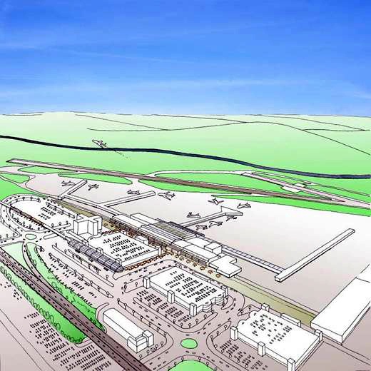
BY 2030 it is hoped to make Glasgow Scotland's hub airport by making provisions for a second runway IF airport usage increases as expected to around 24 million passengers per year. This will require extension of check in and arrivals facilities, achievable by demolition of the present T2 and relocation of cargo facilities. Further plans call for construction of a new east pier, third MSCP and on ramp to the M8, making viable provision of consolidated office and hotel facilities above the terminal building.
RAIL
St Enoch Spur and/or Crossrail : Published 20/12/07 Official site
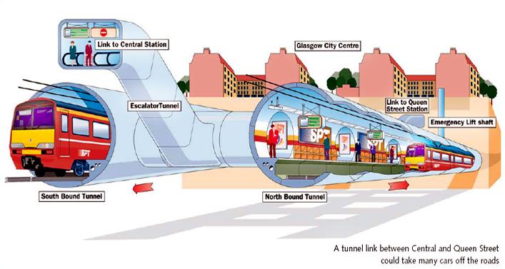
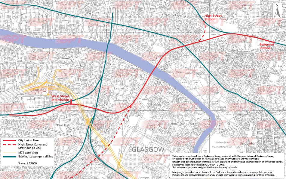
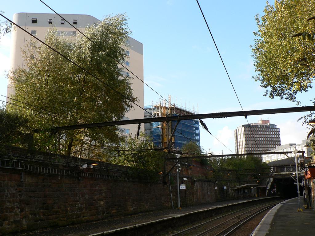
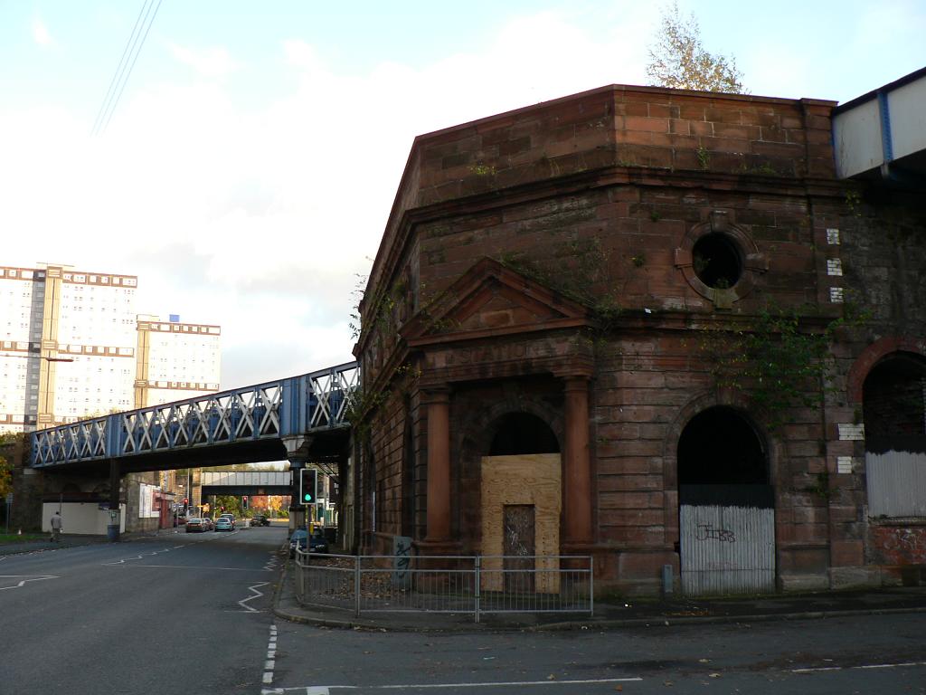
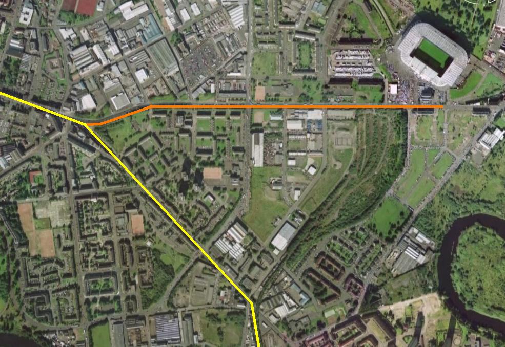
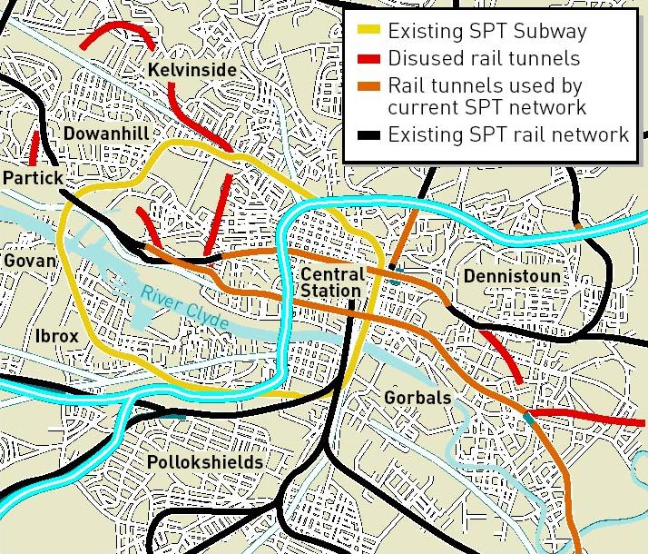
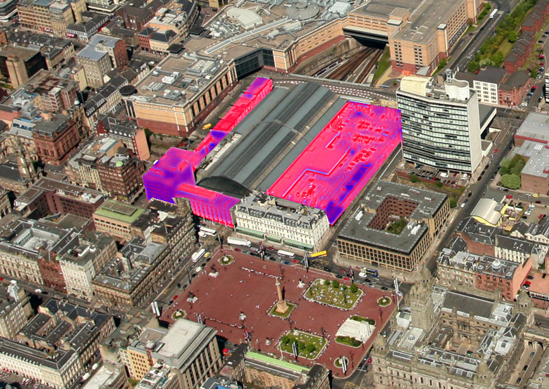
Trains could be pulling into St Enoch Station for the fist time since 1966, when the Beaching axe fell upon the gothic barrel vaulted splendour of the Victorian original, according to the Strategic Transport Projects Review from Transport Scotland. The document postulates the back to the future style station to manage rising passenger numbers and capacity constraints at both Central and Queen Street. Reconstruction of the spur across St Enoch’s Goods Yard, of which only a short aqueduct remains at Trongate, would connect rail networks south and east of the city and allow north bound trains to divert past Central, freeing up capacity. More fanciful measures include construction of a line below the city centre with a new subsurface station around George Square to connect the networks north and south of the city via Queen St and Central Stations.
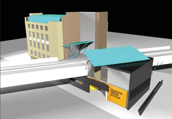
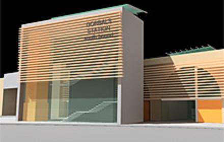
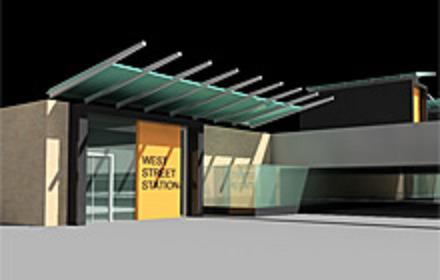
A cheaper alternative would be Crossrail which would reinstate the Goods only City Union line for passenger use and would entail reopening of Glasgow Cross High level for possible interchange with the Argyle line at Glasgow Cross low level. In addition an interchange facility with the subway would be provided at West Street and Gorbals station would be reestablished.
Metro System (Incorporating Clyde Fastlink) : Published 20/12/07 Official site
Establishment of a Metro system would see the conversion of some heavy rail lines, such as the Cathcart circle, into light rail. Such a hybrid system would be able to navigate heavy and light rail lines enhancing operational flexibility. Branch lines could be added to the rail network by utilising disused tunnels along with construction of cut and cover and overground track. One such idea is to reopen the London Road tunnel from Bridgeton to Parkhead thus connecting the SECC with Celtic Park, two of the primary venues for the Commonwealth Games. Following the existing Argyle line to Exhibition Centre it is imagined interchange at Glasgow Cross would open up services to the south but necessitate Argyle St stations closure and an underground pedestrian link could be constructed between Central and St Enoch. Successive phases would see the line extended westward from Exhibition Centre through to Maryhill.
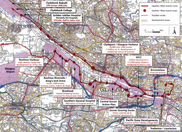
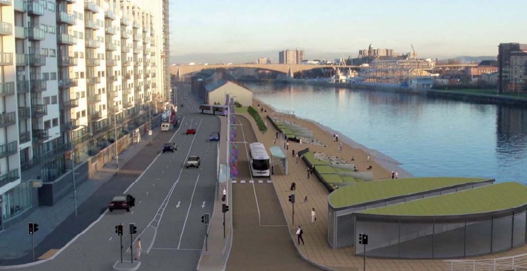
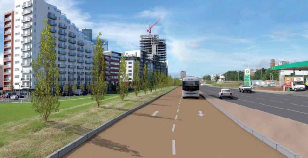
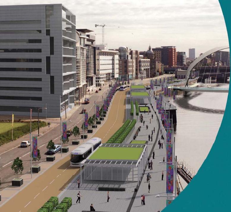
Notice buses will use existing roadway for the restricted stretch in front of River Heights, the scrub land is the site of a later phase of Central Quay. The trams are a medium term ambition likely only to emerge as spine within a wider network.
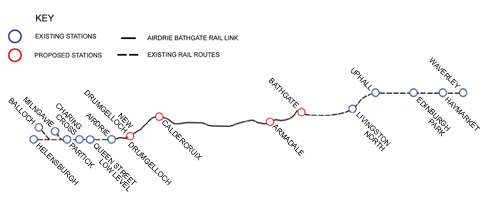
The Airdrie-Bathgate line will serve as an alternative to car travel on the A8/M8 corridor, to achieve this the track east of Bathgate will be doubled and four new stations will be constructed at New Drumgelloch, Calderbank, Armadale and Bathgate.
Queen St Station
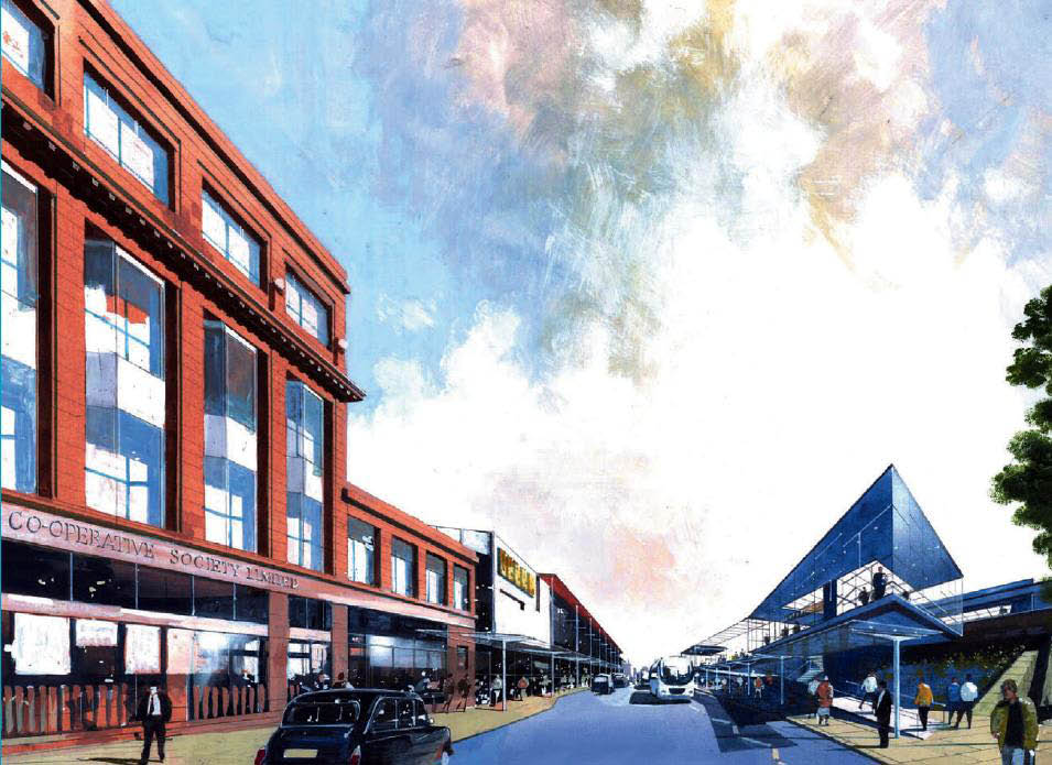
Network Rail are seeking a development partner for Queen Street station adjacent to Buchanan Galleries. A Ł50m redevelopment "could" incorporate office, hotel, residential, retail and/or leisure facilities in a building of "at least" 5 floors around North Hanover St, Dundas St and George St. It is also hoped to enhance entrances, provide new parking facilities and to create new stores within the station concourse.
Partick
This Ł12.3m bus and rail interchange Incorporates a Pedestrian boulevard to Glasgow Harbour. Partick is the third busiest Transport hub in Glasgow with 4 million passengers per year.
Clydebank
This Ł7.75m upgrade forms part of the Clydebank RebuiltMasterplan.
Dalmarnock
Dalmarnocj station could be tarted up in time for the Commonwealth Games.
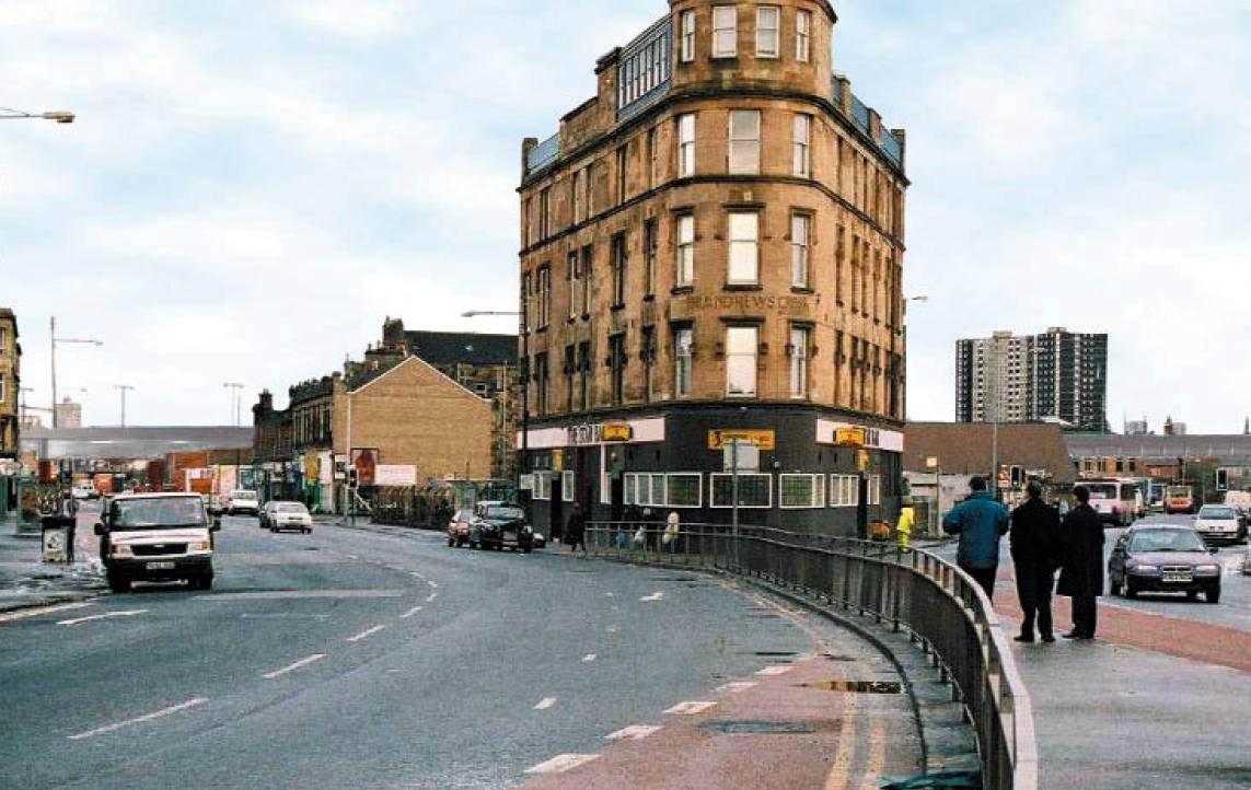
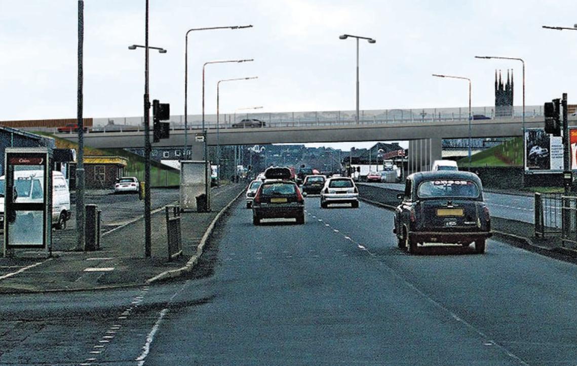
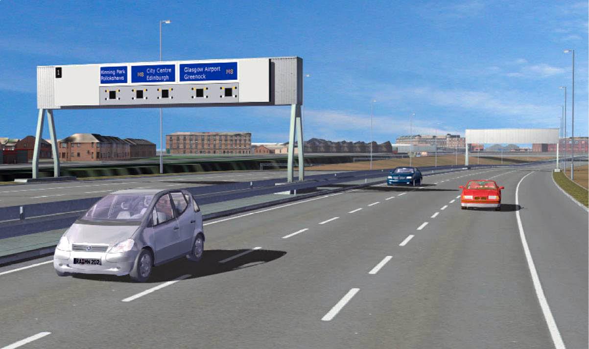
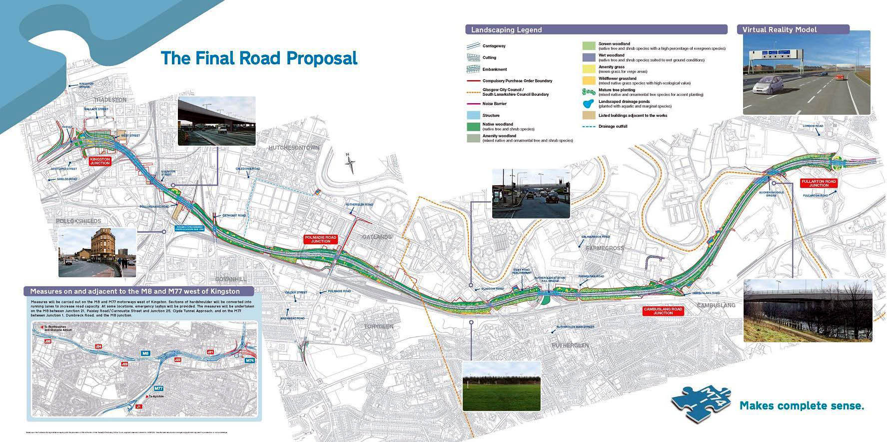
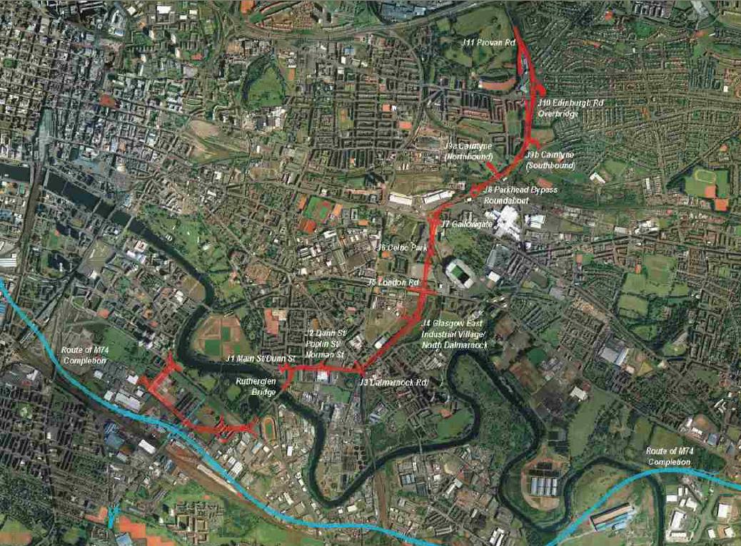
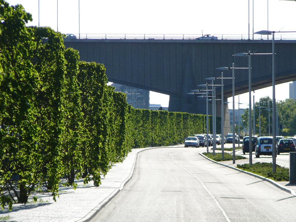
Serving the Clyde Gateway the M74 route will skirt the Laurieston redevelopment area linking Fullarton Junction, Carmyle to the Kingston Bridge thus granting the SE quadrant of the city access to the motorway network. In addition diversion of south bound traffic is thought will limit congestion in the short term through the M8 city approaches.
Environmental impact had dogged the project with gains in reconditioning a corridor of polluted land more than offset by rising emission levels. Detrimental urban impact from discredited overhead flyovers physically seal off the south side and official visualisations appear to show a lack of of provision for south bound Kingston bridge egress. It is likely that gains to traffic fluidity on the Bridge will be muted by congestion to the immediate south where the M74 and M8 merge at a new choke point.
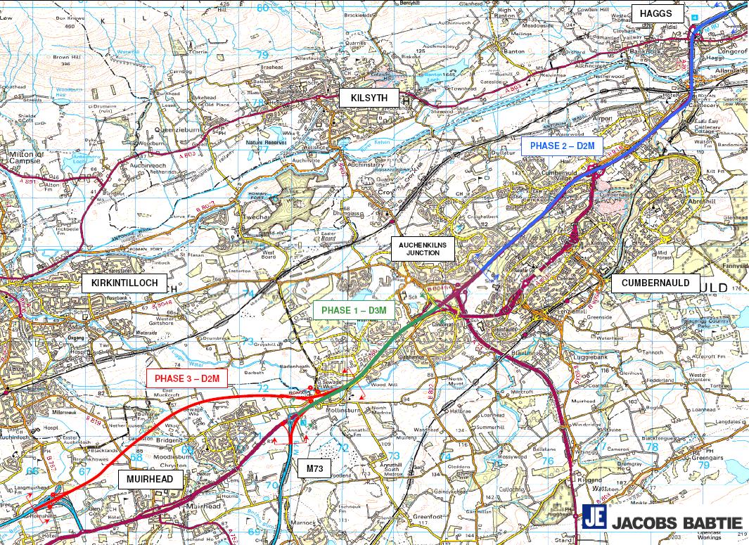
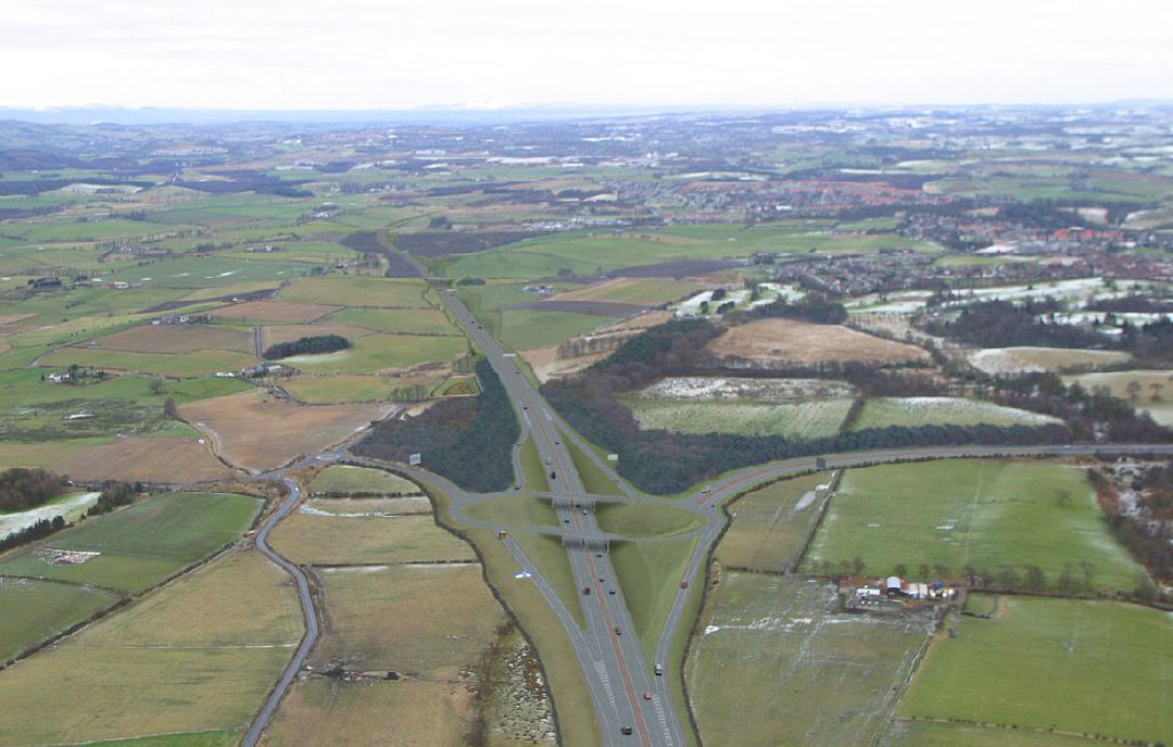
Lanes : 2 lanes + hard sholder (Stepps/Mollinsburn)/3 lanes (Mollinsburn/Auchinkilns)
Start date : 2008
Completion date : 2011
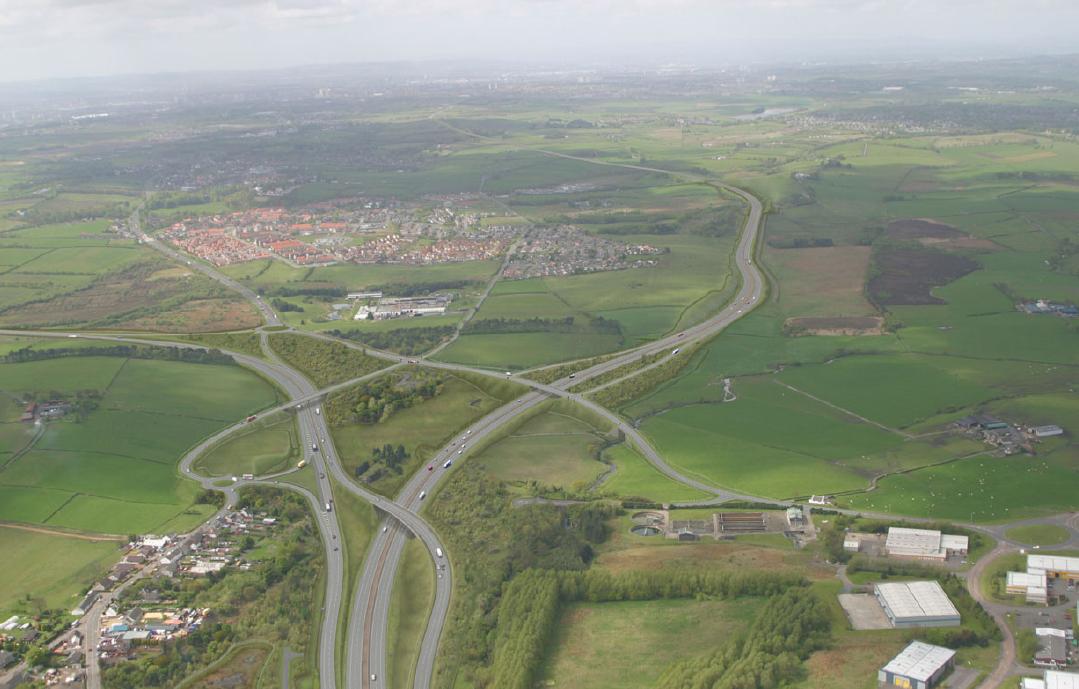
The A80 will link the existing M80 Stepps bypass at Hornshill bypassing Chryston, Moodiesburn and Muirhead following the line of the existing A80 between the M73 and Haggs Interchange. The Hornshill junction (left) will bypass Muirhead, pictured right is the Mollinsburn junction.
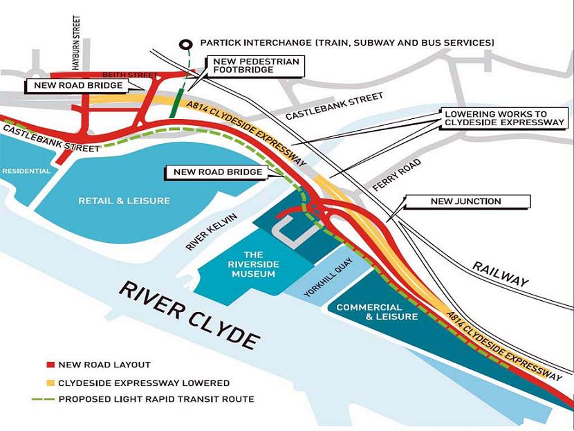
Part of Glasgow Harbour public realm improvements. Works involve new ground level road and pedestrian bridges across the Expressway and river Kelvin, dropping the Expressway by 4m, replacing the Ferry Road roundabout with a new junction and creating a new pedestrian route to Partick Interchange.
Opinion
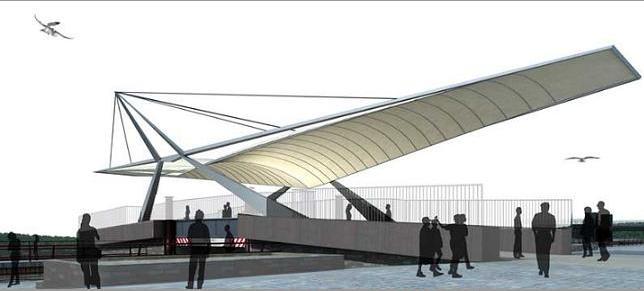
A new canopy will grace a pedestrian footbridge crossing the Forth and Clyde canal connecting Clydebank town centre with Queens Quay. Dynamic night lighting is promised to create a local beacon, although a more abstract design and gravity defying angle gives Aedas scheme (bottom) a grace not evident in the RMJM scheme.
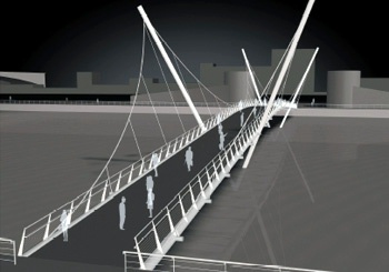
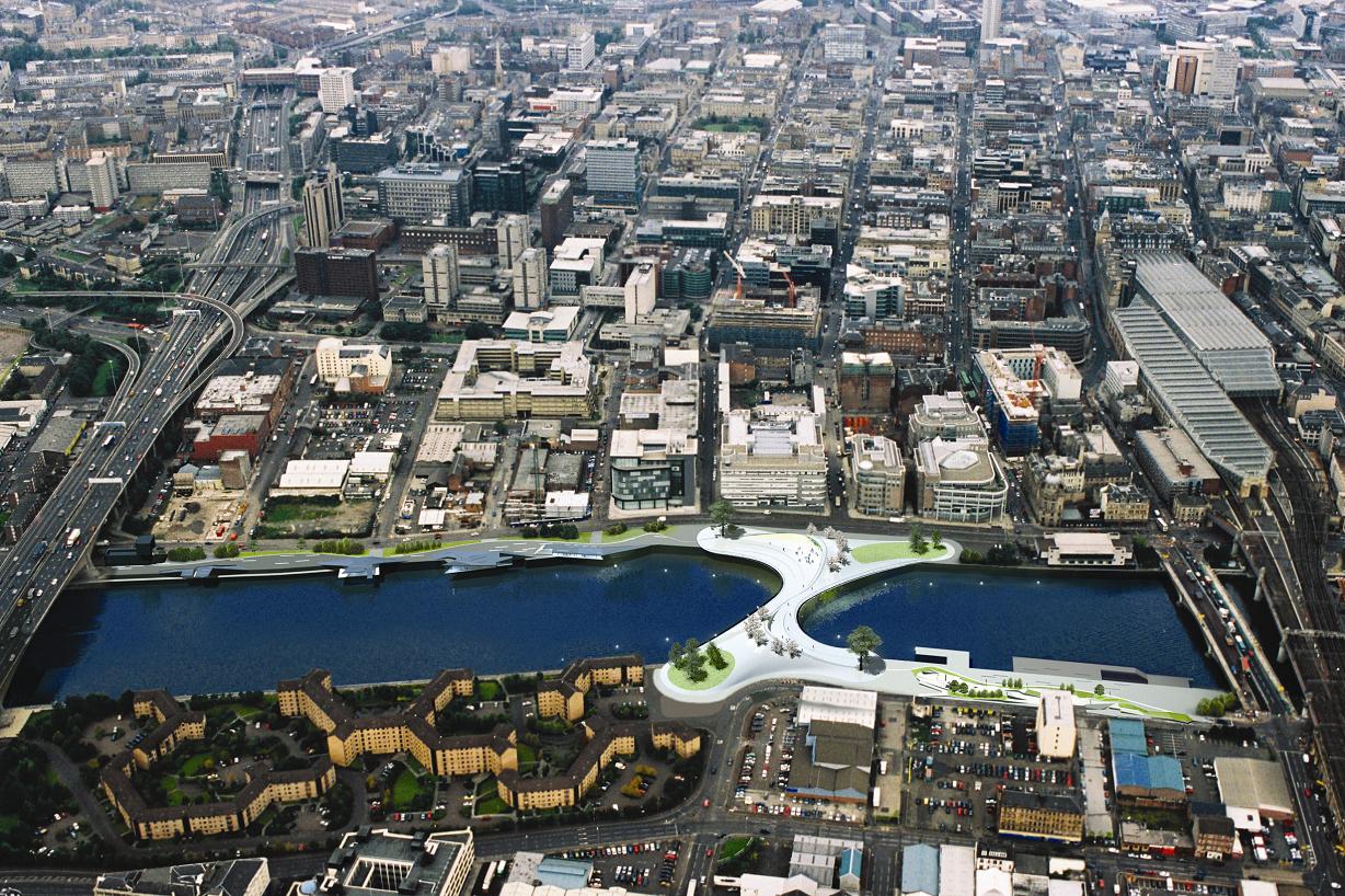
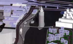
Broomielaw Pavilions and Tradeston Bridge : Published 20/12/06
Materials - Painted steel with reinforced concrete piers
Cost - Ł3-6 million bridge and Ł24-27 million groundworks
Commercial Space - 30,000sq/ft
Location - Broomielaw
Start date - March 2007
Completion date - May 2008
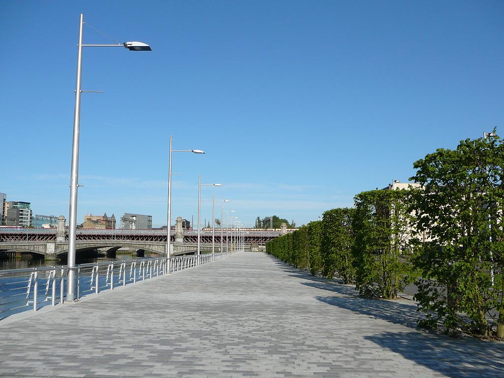
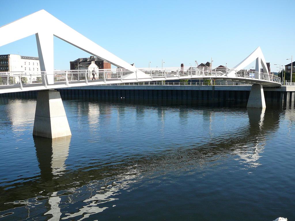
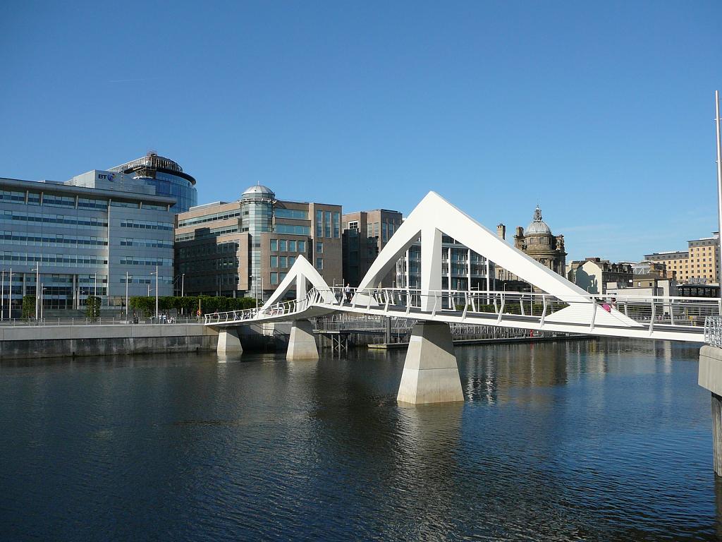
Groundworks currently underway will see significant landscaping although the wisdom of layering additional roadspace over the embankment seems counterproductive and pointless, quicker bus journeys do not approach justifying isolating the river further by dual carriageway. This work follows GCCs botched Tradeston Bridge competition where none of the entries (including the winner) were built. In its stead follows a budget diminutive footbridge to connect the residential Clyde Place to the bustle of the north bank via an industrial steel "S" curve. Natural stone pathways, stainless steel street furniture and feature lighting will complement the new bridge.
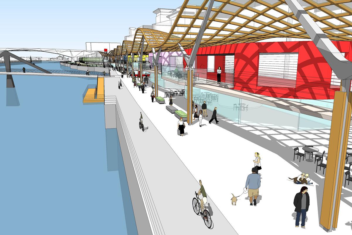
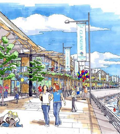
The notion of establishing an all weather riverfront pavilion is a good one with strong historical precedence set by the Victorian ferry terminals and docks which once occupied the site. Opportunity for a symbolic pleasure cruise facility exists although short sighted pedestrian crossings (most notably the Tradeston Bridge itself) impede passage of larger vessels and yachts precluding establishment of a marina or berthing for larger shipping, though with will these impediments could be removed. The need to establish the river as destination is clear, the river historic as it may be is not sufficient draw to achieve significant footfall, a situation not aided by zealous zoning creating an overtly sterile office centric environment.
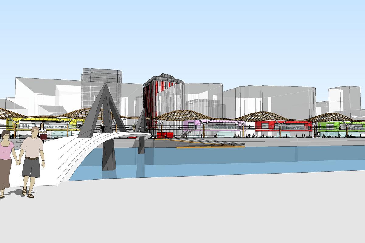
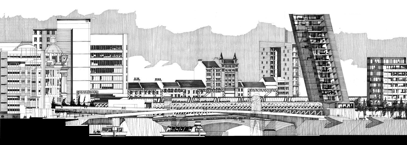
Prior designs Wilson Bowden Developments and BDP's original undulating canopy is attractive and functionally effective visually tying the entirety of the Broomielaw riverfront and animating new commercial development at 220 Broomielaw and Capella. Though it is questionable whether a split level approach of raising primary coloured restaurant pods onto an overhead walkway is either desireable or warranted, this can only reduce pedestrian concentration and overshadow and constrict the spatial qualities of the canopy. Serious questions need to be raised in advance over what type of occupier it is hoped to attract with clear ground rules stipulated to minimise tacky commercial clutter.
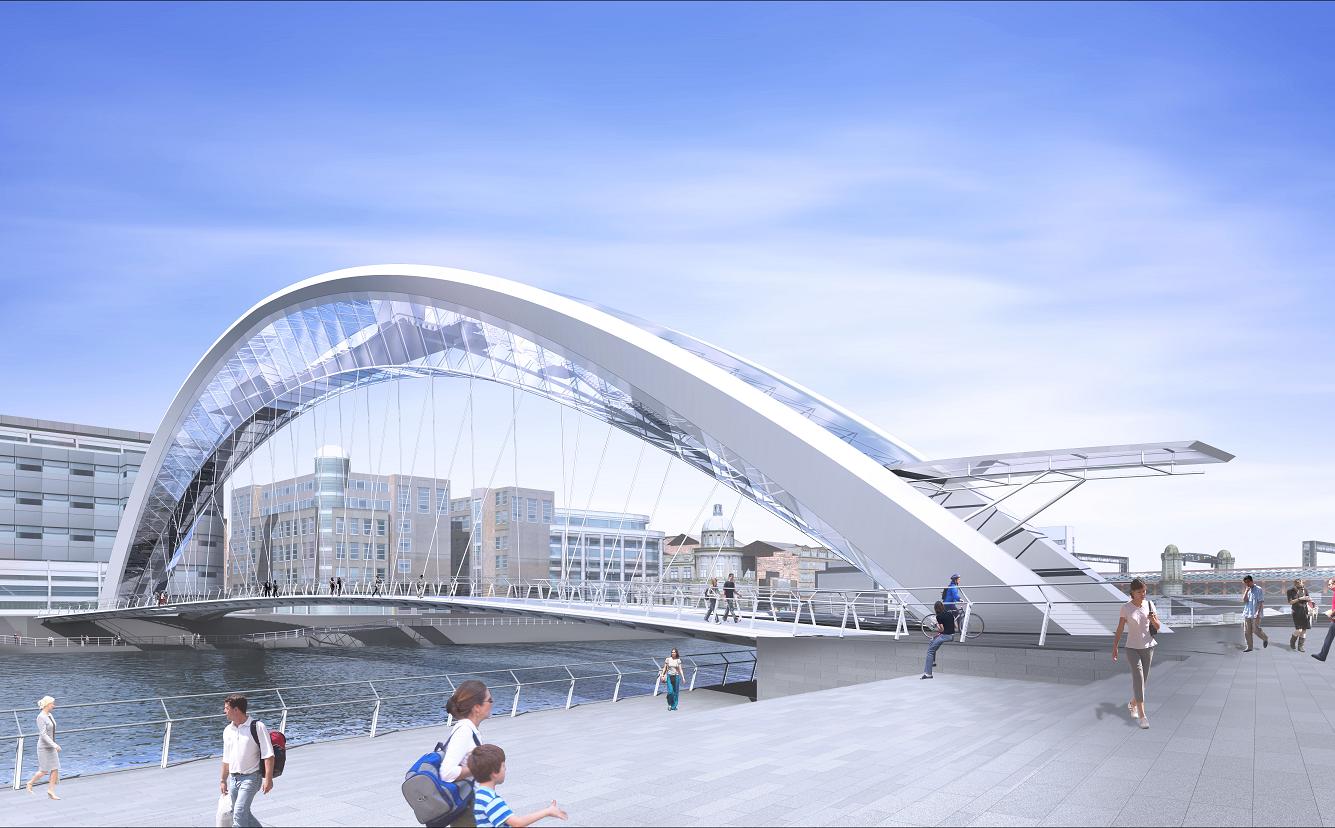
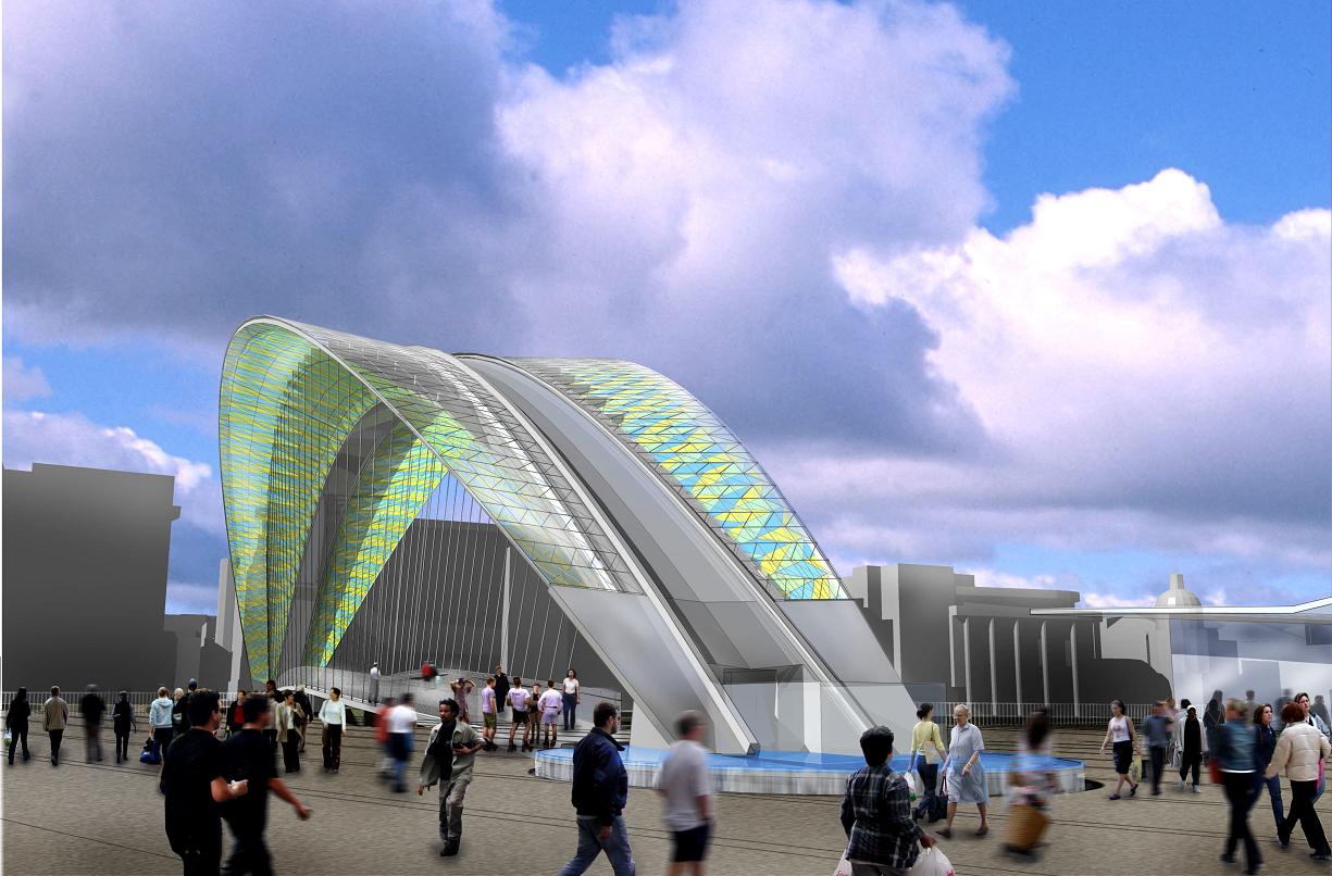
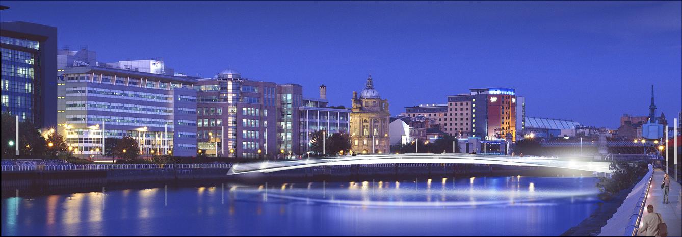
The Ł40 million Glasgow Bridge competition of 2003 has been scrapped due to rising costs, though the scheme will still go ahead under a simpler design (see above), quay walls and public realm will also be improved. Reading from left we have, Richard Roger'sNeptune's Way, the "winner" of the architectural competition, it was nonetheless scrapped due to rising costs, Via by Lifschutz Davidson, Clyde 9 by Studio Bednarski with Austin Smith Lord and People's Crossing by Future Systems with McKeown Alexander and Clyde Tower, Glasgow City Council.
 Infrastructure